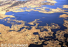
Louisiana Brackish Marsh in Winter
Image#15286 |
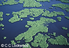
Freshwater marsh in winter
Lacassine National Wildlife Refuge, LA
Image#15828 |
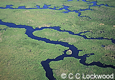
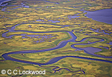
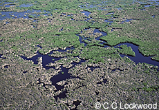
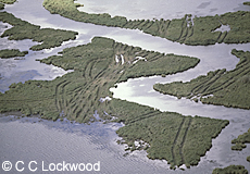
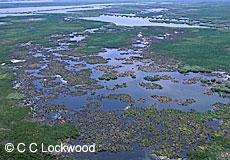
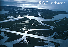
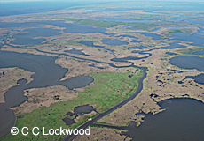
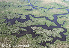
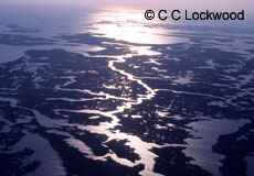
Bayous meander through healthy
intermediate
marsh just north of
Cypremort Point
Iberia Parish, Louisiana
Image#18721 |
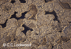
Wire grass (brown) invading fresh marsh
and bull tongue (green) changing it
to brackish marsh
Terrebonne Parish, Louisiana
Image#12844 |
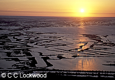
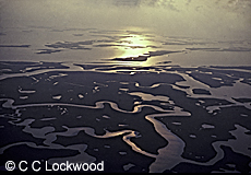
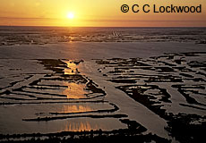
Sunset light over subsiding marsh
at Catfish Lake, west of
Golden Meadow, Louisiana
Image#18715 |
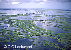
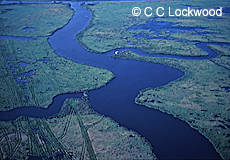
Meandering bayous in freshwater marsh
Terrebonne Parish, Louisiana
Image#12843 |
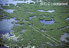
Freshwater marsh with buggy tracks
Cameron Parish, Louisiana
Image#15847 |
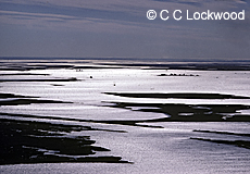
Salt Marsh on Left Brackish on right
Rockefeller Refuge
Grand Chenier, Louisiana
Image#11702 |
|Marsh changing from fresh to salt
Image#15842 |
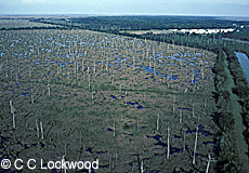
Bald Cypress swamp killed off by
salt water
intrusion from the|
Mississippi River Gulf Project
Image#12842 |
Freshwater marsh in winter
Lacassine National Wildlife Refuge, LA
Image#15831 |
Freshwater marsh in winter
Lacassine National Wildlife Refuge, LA
Image#15814 |
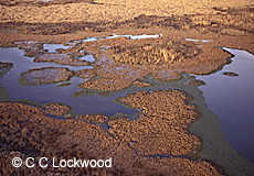
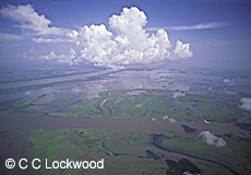
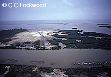
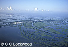
Aerial of Delta National Wildlife Refuge
Louisiana, USA
Image#18203 |
Marsh buggy tracks left by seismic crew
Delta National Wildlife Refuge, Louisiana
Image#18201 |
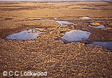
Mississippi River Delta and Delta NWR
above Head of Passes, Louisiana
Image#18204 |
Freshwater Marsh
Mississippi River Delta
Image#15834
|
Spoil deposit from Corps of Engineer
dredge
in the Mississippi River Ship
Channel, deposited into
Vermilion
Bay to
help build new marsh
Image#10362
|
Barataria Bay
Image#15843
|
Dying marsh as viewed from the air
Rockefeller Refuge
Grand Chenier, Louisiana
Image#10201
|
Damaging marsh buggy tracks
from seismic crews will take
years to heal
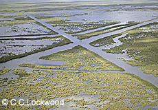
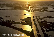
Image#15261 |
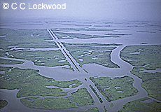
The straight man-made canal contrasts with
natural meandering bayous. The canals
bring saltwater into
the fresh marsh
Image#15735
|
Marsh overgrazed by muskrats
Cameron Parish, Louisiana
Image#15849 |
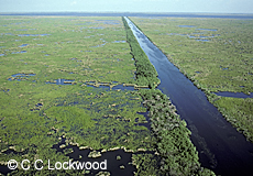
Straight canals dredged through marsh
Mississippi Delta, Louisiana
Image#16977 |
Terracing efforts to save eroding marsh
*Image#LS-AERIAL-2531 |
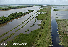
Pipeline canal through fresh marsh
near Lafitte, Louisiana
Mississippi River Delta
Image#15840 |
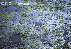
Freshwater Marsh
Salvador Wildlife Management Area, Louisiana
Image#15835 |
Canals can introduce salt water
into freshwater marsh
Cameron Parish, Louisiana
Image#15848 |
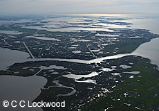
Terrebonne Parish wetlands looking east
*Image#20040330-NG-ATCH-0022
|
Terrebonne Parish Marsh
*Image#20040330-NG-ATCH-0028 |
Terrebonne Parish Marsh
*Image#20040330-NG-ATCH-0035 |
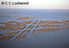
Pipeline Canals around Catfish Lake
Lafourche Parish, Louisiana
Image#19329 |
Pipeline Canals around Catfish Lake
Lafourche Parish, Louisiana
Image#19326
|
Pipeline Canals around Catfish Lake
Lafourche Parish, Louisiana
Image#19328 |
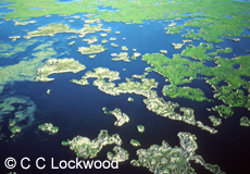
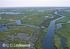
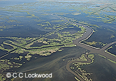
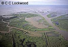
Healthy Marsh with natural meandering bayous
Cypremort Point, Louisiana
Image#19321
|
Atchafalaya Bay Delta at Wax Bay Outlet
Atchafalaya Basin, Louisiana
Image#19316
|
Oil field called the "Wagon Wheel"
near Venice Louisiana
Plaquemines Parish, Louisiana
Image#19791 |
|
|
Fragile vanishing salt marsh west of Empire
after Hurricane Rita
Plaquemines Parish, Louisiana
Image # 20465 |
|
|
See also:
Atchafalaya
Swamp Basin Aerials
Aerials of
Farmlands
Wetlands
Salt Marsh
Barrier Islands
Efforts to Save Wetlands
Saltwater Intrusion
Brackish Marsh
Freshwater Marsh
Coastal
Erosion
Various Marshes
|
For information on Stock Photography call 225-769-4766

Prints of
some images are available in signed editions of various
sizes.
see
http://www.cclockwood.com/gallery/limited.htm or
call the gallery 1-800-414-4685 |