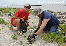
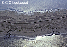
Planting marsh grass to save fragile
shoreline Note: Jetties in background
Chenier Au Tigre, Louisiana
*Image#EN-MARSHRESTORE-2671
|
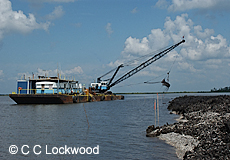
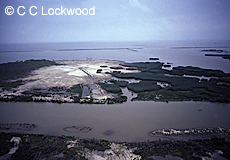
Dredging to build up banks
*Image#EN-MARSHRESTORE-3081 |
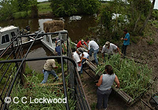
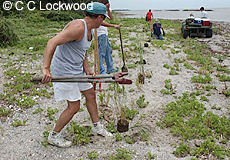
Loading marsh grass for planting
along eroding shoreline
Chenier Au Tigre, Louisiana
*Image#EN-MARSHRESTORE-2665
|
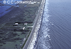
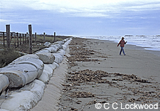
LA Hwy. 82 has been rebuilt on landward
side due to coastal erosion
Johnson's Bayou, Louisiana
Image#15734 |
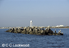
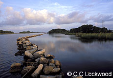
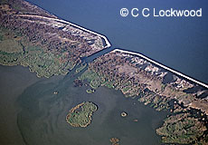
Rock jetties built to protect priceless
marsh from further erosion
*Image#EN-MARSHRESTORE-1072 |
Rock jetties built to protect Grand Isle
from coastal erosion
Grand Isle, Louisiana
Image#15804 |
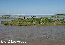
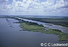
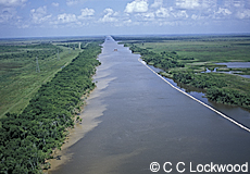
Newly accreted land in the Atchafalaya Bay
Atchafalaya Basin, Louisiana
Image#14833
|
Concrete protection levee on
barrier island beach
Fourchon, Louisiana
Image#15873
|
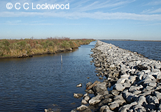
Rocks lining GIWW to stop
boat wake erosion
Calcasieu Parish, Louisiana
Image#17649 |
Terracing project to promote marsh grass
growth in eroding marsh
Calcasieu Parish, Louisiana
Image#17643
|
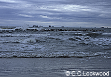
Waves breaking over rock jetties built to
protect shore from erosion
Grand Isle, Louisiana
Image#16779 |
The Gulf Intracoastal Waterway's unprotected
left bank is eroding,
rocks protect the right side of the canal
Calcasieu Parish, Louisiana
Image#17636 |
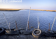
Tires put out to control erosion where
two oil field canals meet.
Leeville, Louisiana
Image#13233 |
Rock jetties built to help slow coastal
erosion
Grand Isle, Louisiana
Image#15981 |
Spoil deposit from Corps of Engineer dredge
in the Mississippi River Ship Channel, deposited into
Vermilion Bay to
help build new marsh
Image#10362
|
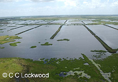
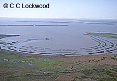
Terracing efforts to promote growth
and slow currents to save eroding marsh
*Image#LS-AERIAL-2518
|
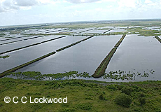
Terracing efforts to save eroding marsh
*Image#LS-AERIAL-2516 |
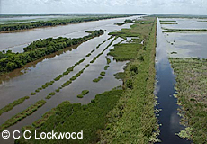
Terracing efforts to promote growth
and slow currents to save eroding marsh
*Image#LS-AERIAL-2531 |
Image#20677
Break in rock dyke along lower MS River to let
freshwater and sediment into the eroding and subsiding
marsh
Plaquemines Parish, Louisiana
|
Terracing project near Intracoastal City
to repair marsh
Vermilion Parish, Louisiana
Image#19324 |
|
|
See Also:
Coastal Erosion
Wetlands
Aerials
of Wetlands
Saltwater Intrusion
Salt
Marsh
Brackish Marsh
Freshwater Marsh
Various Marshes |
For information on Stock Photography call 225-769-4766

Prints of
some images are available in signed editions of various
sizes.
see
http://www.cclockwood.com/gallery/limited.htm or
call the gallery 1-800-414-4685 |